
ISLAND ROUTES
Galapagos Islands Map: Airports, Bases & Day Trips
Find the places you want to visit, then choose the island stays and flights that connect them.
THE SHORT ANSWER
The Galapagos Islands are part of Ecuador, in the Pacific Ocean west of the mainland. For a hotel-based trip, start with three island bases: Santa Cruz, San Cristóbal and Isabela. Baltra Airport serves Santa Cruz through a channel crossing and road transfer; San Cristóbal has its own arrival airport. Day-trip sites are separate destinations, so locate them before choosing your hotels or flights.
Explore the Galapagos Islands map
Select an island base or excursion below to see how it fits a land-based visit. The map shows the central and southern visitor islands, with north at the top and the Equator marked. Darwin and Wolf lie farther northwest and are outside this view.
Coastlines show geographic position; the highlighted connections are planning lines, not boat tracks, timetables or a navigational chart. A nearby island on a map is not necessarily available as a day excursion from your hotel.
Island bases
Airports & visitor sites
Santa Cruz
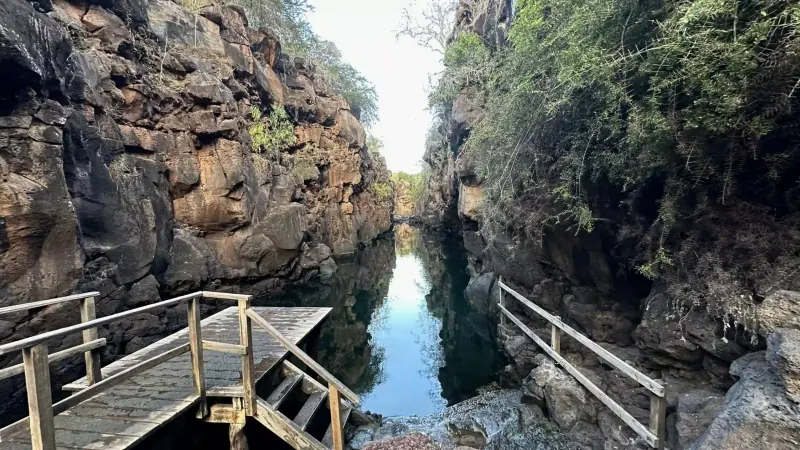
Puerto Ayora · via Baltra (GPS)Stay in Puerto Ayora for Las Grietas, Tortuga Bay and selected offshore excursions. Baltra arrival requires a channel crossing and road transfer.
Read the Santa Cruz planning guide →Connections are schematic and do not represent scheduled services. Open or save the map. Coastlines: Natural Earth · © OpenStreetMap contributors.
Where are the Galapagos Islands in Ecuador?
The archipelago belongs to Ecuador but is separated from the mainland by the Pacific. On a wider map of Ecuador, look west to find Galapagos. Within the archipelago, Santa Cruz is central, Isabela is farther west and San Cristóbal is to the southeast. The Equator crosses the northern part of Isabela.
For your travel plan, there are two different questions: how to reach the islands from mainland Ecuador, and how to move between your island stays. Plan the mainland flight and the island route together. A flight to Baltra does not take you directly to a hotel on Isabela or San Cristóbal.
Match the airport with your first island base
For arrivals from mainland Ecuador, compare Baltra (GPS) and San Cristóbal (SCY). Baltra is a separate island north of Santa Cruz. The transfer to Puerto Ayora involves airport transport, the Itabaca Channel crossing and a road journey across Santa Cruz. Keep all three stages in the plan.
San Cristóbal Airport is on the same island as Puerto Baquerizo Moreno. Isabela is a separate stay with its own onward connection; do not read an airport symbol as proof that your mainland airline serves that island. Check the actual ticket, departure point and transfer arrangements before booking.
| Island base | Arrival planning | Examples to investigate |
|---|---|---|
| Santa Cruz · Puerto Ayora | Baltra (GPS), then channel and road transfers | Tortuga Bay, Las Grietas and selected offshore day trips |
| San Cristóbal · Puerto Baquerizo Moreno | San Cristóbal (SCY), then local hotel transfer | Local coast and a guided Kicker Rock excursion |
| Isabela · Puerto Villamil | Arrange the connection from your preceding island | Los Túneles and island activities, subject to the agreed program |
Day-trip locations: choose the right starting island
Bartolome lies east of Santiago, north of Santa Cruz. For a hotel-based visit, investigate an authorized day excursion during your Santa Cruz stay. The viewpoint, boat travel and any proposed snorkeling belong in the same day plan. North Seymour is another offshore option to compare; the destinations are alternatives when your itinerary allocates one island excursion.
Kicker Rock, also called León Dormido, is off San Cristóbal. It makes sense to discuss it while planning that island stay. Las Grietas is much closer to Puerto Ayora on Santa Cruz, reached by local access arrangements and a walk. These visits have different transport demands, even though all three can appear on a list of Galapagos attractions.
Use the map to group your priorities by base. Then ask which sites are feasible on your dates, what each outing includes and how much of the day is spent traveling. A geographic connection alone does not confirm visitor access or availability.
Turn the map into a 5, 7 or 8-day route
Our starting itineraries use different combinations of these bases. Five days keeps your hotel on Santa Cruz. Seven days adds Isabela and returns to Santa Cruz before departure. Eight days starts on San Cristóbal, continues through Santa Cruz to Isabela, then returns to Santa Cruz for the final night.
That return matters when reading a simple island-hopping diagram: an itinerary can visit three islands while requiring more than two transfers. Count the nights as well as the stops. Arrival, checkout, luggage and onward transport reduce the time available for activities.
| Length | Island-stay order | Arrival → departure |
|---|---|---|
| 5 days / 4 nights | Santa Cruz | Baltra → Baltra |
| 7 days / 6 nights | Santa Cruz → Isabela → Santa Cruz | Baltra → Baltra |
| 8 days / 7 nights | San Cristóbal → Santa Cruz → Isabela → Santa Cruz | San Cristóbal → Baltra |
Check these details before booking the route
Write down your two or three priority experiences, possible dates and available island nights. Mark the base for each experience, then check whether your preferred order needs a return transfer. If you dislike frequent hotel changes, a single base with selected day trips may be a better starting point than maximizing the number of islands.
Ask for the actual arrival and departure airports, overnight locations, transfer inclusions and excursion alternatives in the proposal. Compare that outline with your flight tickets. Leave room to discuss conditions and availability before treating any route on a Galapagos map as a confirmed reservation.
Sources and planning notes
Island facts and visitor guidance are checked against the sources below. Suggested day allocations are our planning recommendations; the linked GLBT itineraries describe our proposed routes. Access, services and the final price are confirmed in your personal quote.
Before you decide
What country do the Galapagos Islands belong to?
The Galapagos Islands belong to Ecuador. They lie in the Pacific Ocean west of mainland Ecuador, with the Equator crossing part of the archipelago.
Which Galapagos airport should I choose?
Choose around your first and final island stays. Baltra serves Santa Cruz through channel and road transfers; San Cristóbal Airport serves the island of San Cristóbal. Our eight-day outline arrives at San Cristóbal and leaves from Baltra.
Is Baltra the same island as Santa Cruz?
No. The Itabaca Channel separates them. After landing at Baltra, continue to the channel, cross to Santa Cruz and travel by road toward your accommodation.
Can I visit Kicker Rock from Santa Cruz?
Plan Kicker Rock around a San Cristóbal stay and a confirmed local excursion. Do not assume that an inter-island transfer from Santa Cruz connects with the excursion on the same day.
Does the map show a fixed ferry schedule?
No. It shows locations and schematic connections for planning. Confirm transport, departure points and times for your dates with the services in your proposal.
Can I download this Galapagos Islands map?
Yes. Use the map link below the interactive view to open or save the illustrated planning map. It is for orientation, not marine navigation.
LET’S PLAN YOUR TRIP
Turn your island choices into a route
Send your dates and the places you most want to visit. We will help connect your hotel stays, excursions and arrival airports.
Request my trip proposalCompare the 5, 7 and 8-day routes →
No payment needed to inquire. Your proposal confirms availability, inclusions and price.
Request your Galapagos trip proposal
Start with your name and email. Add approximate dates and travelers if you know them; we will reply to help plan the details.